Wednesday, August 16, 2006 –
This morning we decided to head up to the north side of the Big Island. We were about to do something really special: kayak through old irrigation ditches!
It’s not really as bizarre as it sounds. Our adventure with Kohala Ditch Adventures was called “Flume Da Ditch” located on the northern Kohala Coast of the Big Island. We met up with our guides and got geared up with life preservers and head lamps before loading up in 15-passengers vans. They van carried our rubber kayaks on a back trailer.
Flumin’ Da Ditch
As we drove up several bumpy, dirt roads, I thought we were going to lose the kayaks at one point when we heard a pop. The driver parked then van and got out to check on the almost jackknifed trailer! It was okay, so we continued on the private trail until we arrived at the “ditch.” More than 100 years ago, the Kohala Ditch channeled stream and ground water to a local sugar cane plantation along a 17-mile-long stretch. Every year millions of gallons of water flow down the ditch, and today we would join along for the ride.
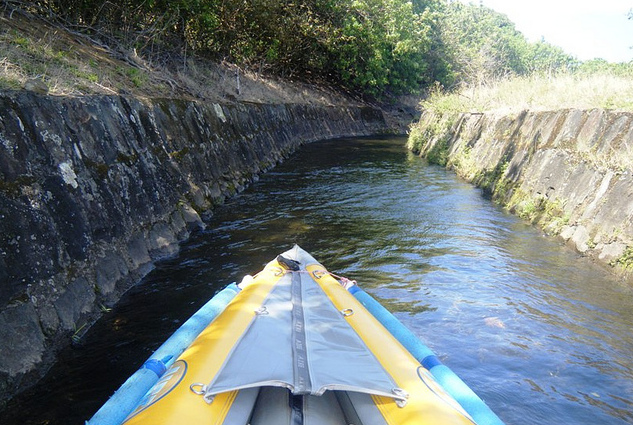
After a short hike from the van, we saw a small beautiful waterfall. Then we were at the ditch. Upon loading up – two to each kayak – we traveled most of the ditch single file for 2.5 miles. It was truly magnificent floating peacefully under Hawaiian rainforest and among the local flora. We also passed through 10 earth tunnels where we had to use our headlamps. A few places along the way, we went down some water flumes that had small little rapids. Along the way, our guides told us about the rainforest and history of the sugar plantations and water channels.
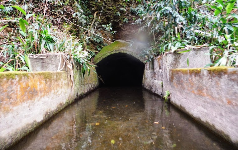
Entering an irrigation tunnel
Upon finishing the tour back at Kohala Ditch Adventures, we changed clothes and drove around the north side of the Big Island on Highway 270. We turned off on to Old Coast Guar Road to drive to the north tip of the Big Island. Close to the small Upolu airport, we visited the Kamehameha Akahi Aina Hanau. This site was the birthplace of King Kamehameha the Great in 1758. He was consider the greatest king of Hawaii and united all the Hawaiian Islands. There is no structure left, but there are thick walls made from thousands of carefully placed stones. The site offer stunning views of the Pacific Ocean and green hills.
Later we drove to Hawi, a town famous as the turn-around spot for the cycling leg of the Ironman World Championships. We had sandwiches for lunch at the Hawi Hale. Then we drove down the end of Highway 270 past windmills towards the Pololu Valley Lookout. Along the way the black lava landscapes of the Kohala Coast gave way to the green pastures of North Kohala, At the end of the highway, we parked in a parking lot and enjoyed the amazing view from the Pololu Valley Overlook. We saw the green cliffs of the Pololu Valley and the dramatic northeastern coastline with its gorgeous black sand beach at the mouth of the valley.
After leaving the Pololu Valley Overlook, we took Highway 250 from Kapaau and then Highway 19 into cowboy country past the Parker Ranch. Then we traveled northwest on Highway 240 to the Waipio Valley Overlook, one of the best valley overlooks in Hawaii!
This evening after a long day of driving, we headed back to Waikoloa and had dinner before going back to the hotel to relax.
Categories: Big Island, Hawaii, North America, United States
